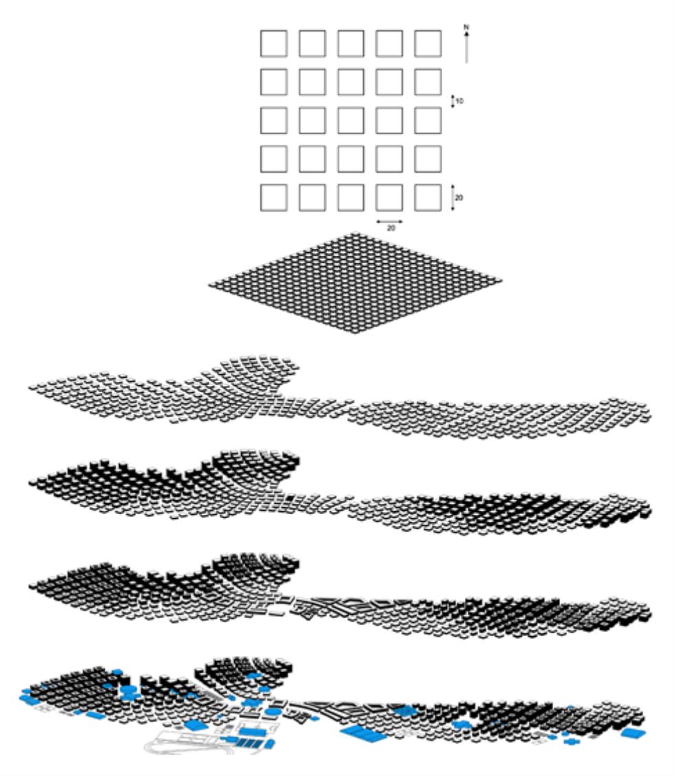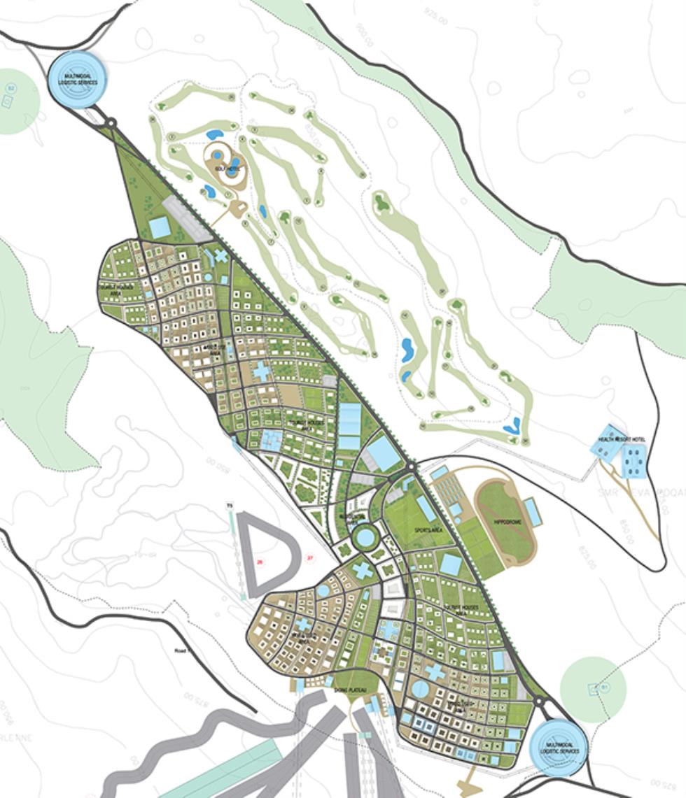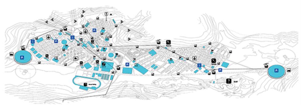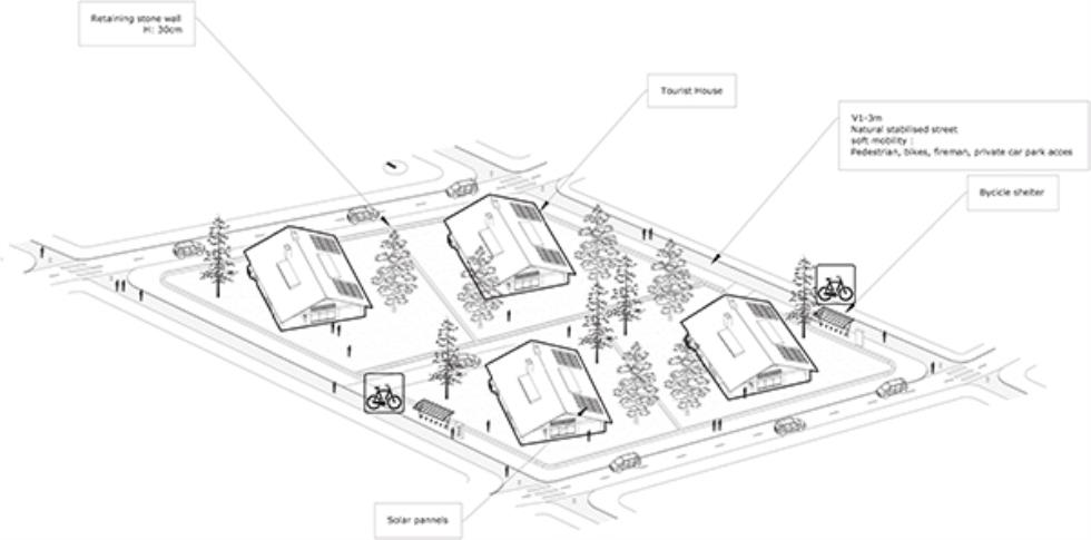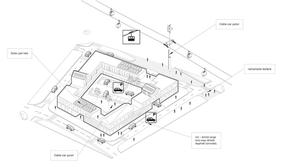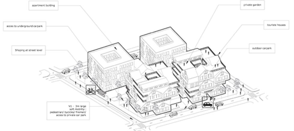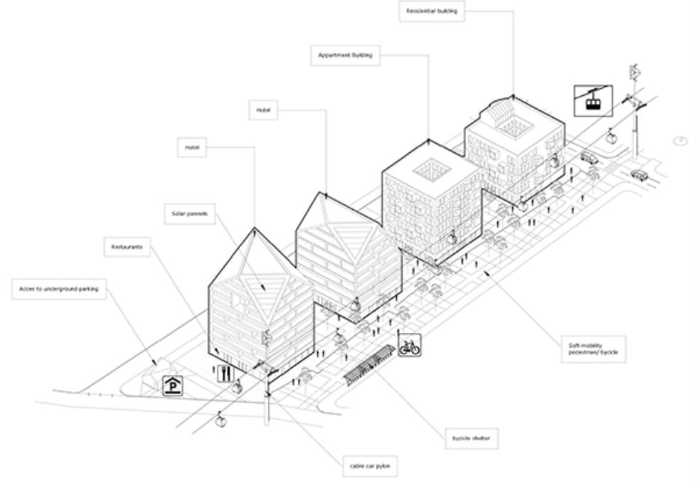
The bias of SO/AP agency was to design an urban pattern generated by tools for parametric programming. The urban grid, the study of heights and typology of housing are the optimized results from simulations between a 3D parametric design software, and software for environmental analysis.
SO / AP机构的偏见是设计由参数化编程工具生成的城市模式。城市网格,高度和房屋类型的研究是三维参数化设计软件与环境分析软件之间的模拟优化结果。
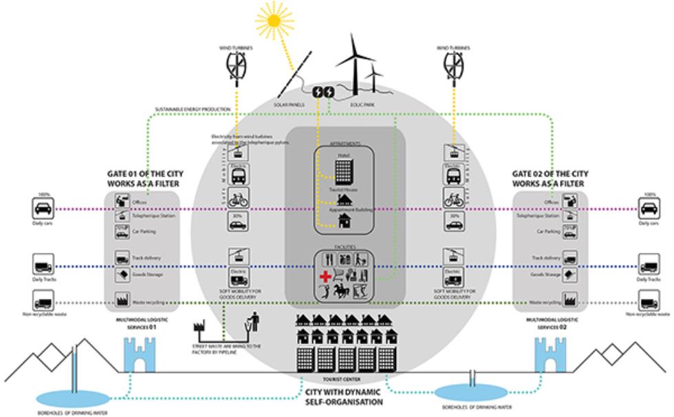
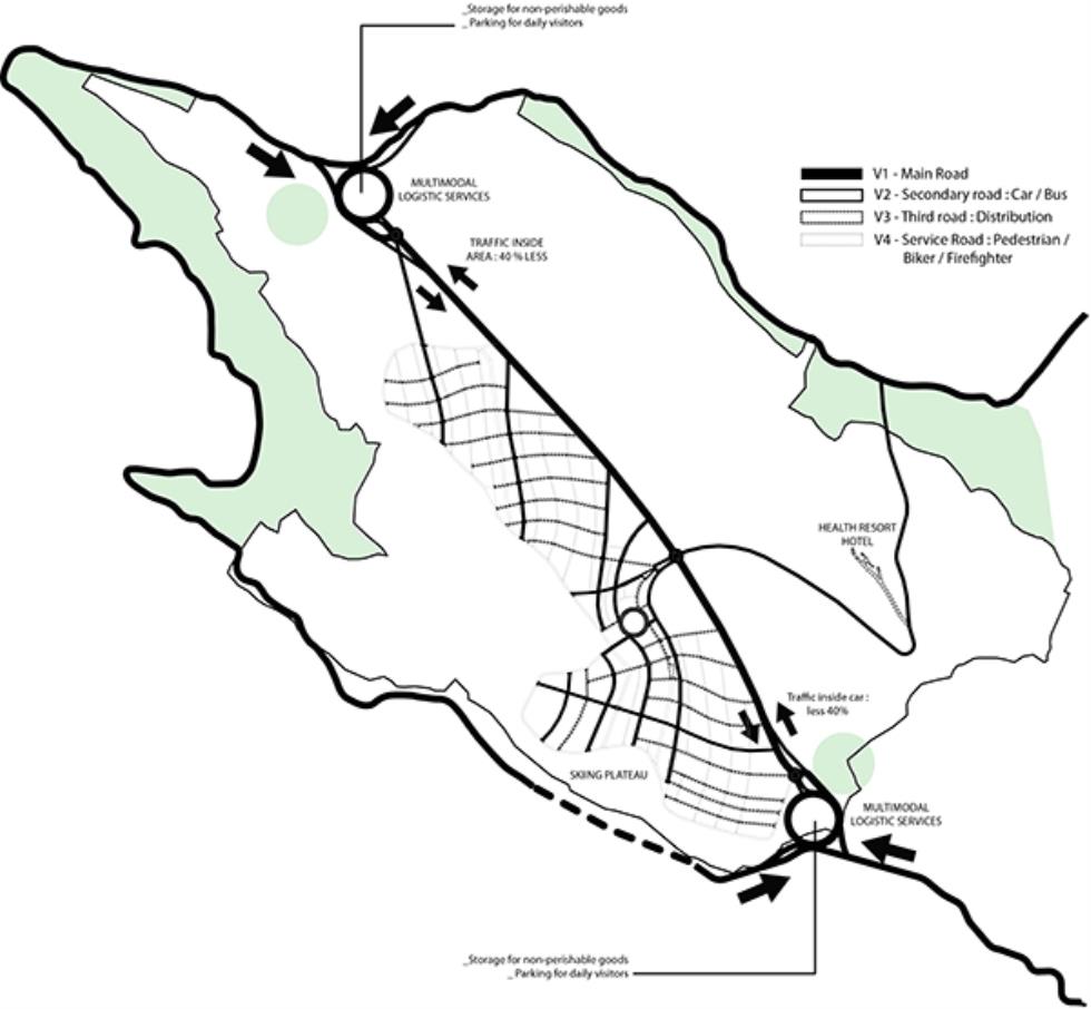
All data as solar radiation, natural lighting condition, thermal performance and water consumption have been integrated to the urban design from the beginning. In order to benefit of the ski lift both in summer and winter, the city is implanted at the foot of the skiing plateau and extends westward into the hillside in order to preserve as much plain in its natural states as possible. As this plain is serviced at is two end points, the projects also plan to build two gateway permitting simultaneous the access and the storage of the goods without having to access to the city.
所有的数据如太阳辐射,自然采光条件,热性能和耗水量已从一开始就融入了城市设计。为了夏季和冬季的滑雪缆车的利益,该城市被植入滑雪高原的脚下,并向西延伸到山坡上,以尽可能保持自然状态下的平原。由于这个平原的服务是两个终点,这些项目还计划建立两个门户,允许同时访问和存储货物,而无需进入城市。
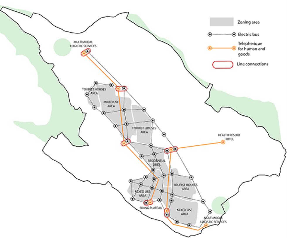
Between these two extremities three poles can be distinguish, the first one is at the bottom of the slopes and is oriented in the winter sports, at the other end toward the plain the city is focused on the summer recreation. These two poles are connected through a third one which is more access on the residential and sports area.
在这两个极端之间可以区分三个极点,第一个极点位于斜坡的底部,面向冬季运动,另一端朝向平原,城市侧重于夏季娱乐活动。这两根柱子通过第三块柱子连接起来,在住宅区和运动区更容易进入。


